Community Forest Garden – Survey
Survey
Landform
The site is level and South facing.
Elevation 147m above sea level.
It is surrounded on two sides by heavily wooded steep banking, on one side by a wooded strip alongside the canal. The slopes do not show signs of erosion.
The third side is adjacent to the Healthy Minds allotment site and beyond that a wild area full of trees, Himalayan Balsam and Japanese Knotweed.
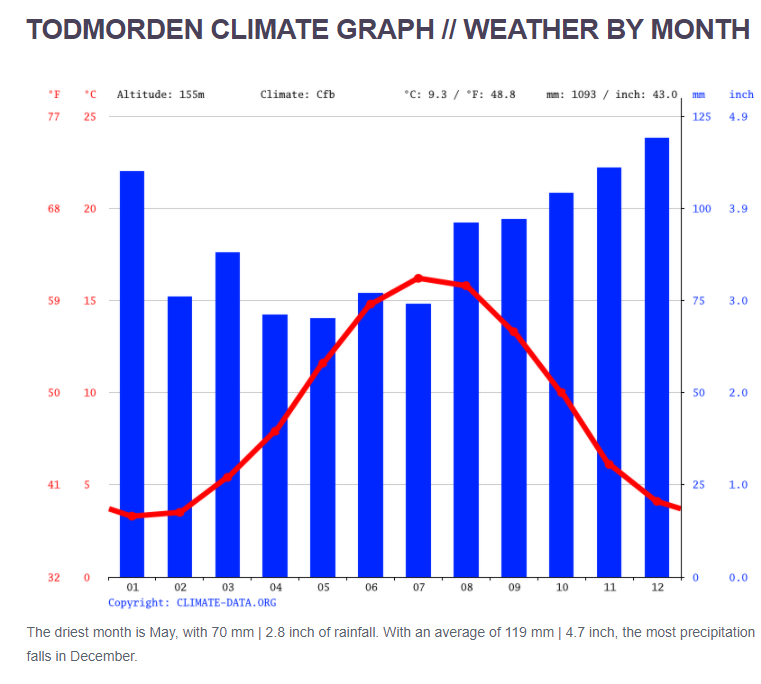
Climate
Water
There are no sources of water on site. The soil holds water well.
The nearby canal could be used as a source of water for plants if needed.
Access and Boundaries
Physical
- There are good footpaths leading to the site. However, there is no vehicular access. This could restrict delivery of any bulky items.
- There are no strong desire lines through the site.
Financial & Human
- As yet the group does not have a pot of money.
- The amount of work carried out at the site is reliant on volunteers having the time, knowledge and confidence to carry it out.
Views
- The most open views from the site are possibly those looking west towards the canal. However, there really isn’t a bad view.
- The site is overlooked on all sides from passers by. The site can also be seen from the canal towpath.
Hazards & Risks
Physical
- Trip hazards from unruly brambles and fallen wood.
- Littering and occasional dog faeces
- Lack of handwashing and toilet facilities on site – this would become more important if the site is used as a social space.
- In winter the site can become waterlogged, muddy and slippery underfoot.
- Around a foot down is unknown industrial metal waste.
Human
- Burnout, people take on too much responsibility and if it’s not paid work it can become overwhelming if it’s not a collaborative effort.
- Lack of funding
- People involved move away or become too busy to participate, and the enthusiasm and knowledge becomes lost.
Resources
- Logs and brash
- Water (from canal)
- Fertile soil
- Current native plants
- Volunteers – Knowledge and labour
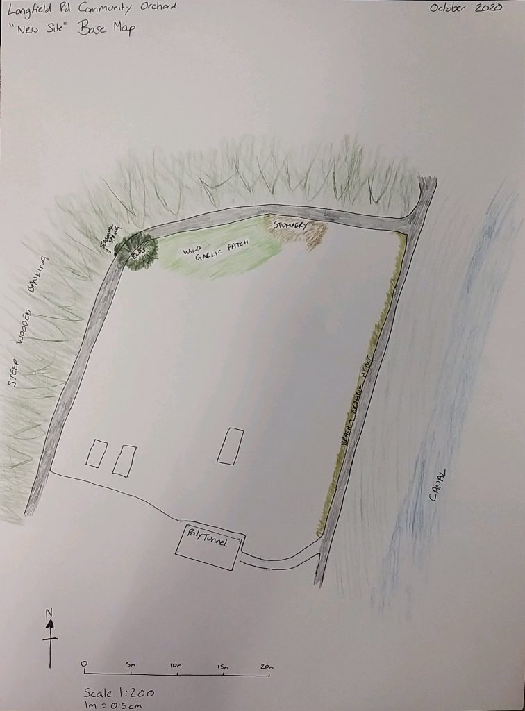
Base Map
I need to identify which fruit trees are in their permanent locations and map them (with variety if possible). Due to the quantity of trees on site, it is almost impossible to accurately map each individual specimen.
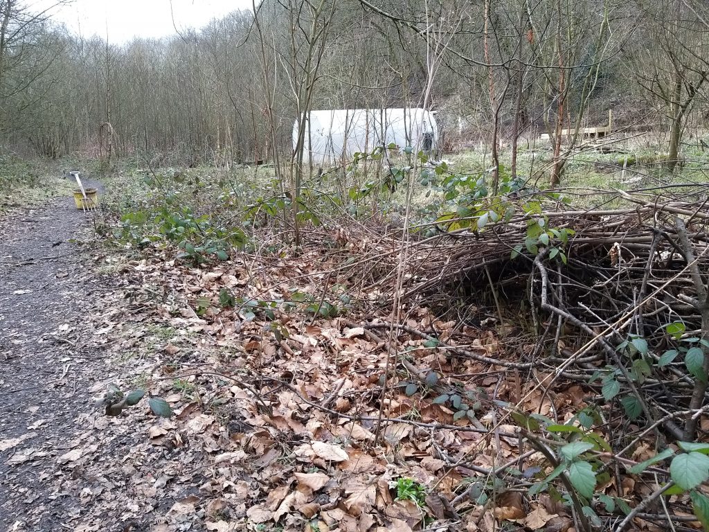
Site Photos
Eastern Border 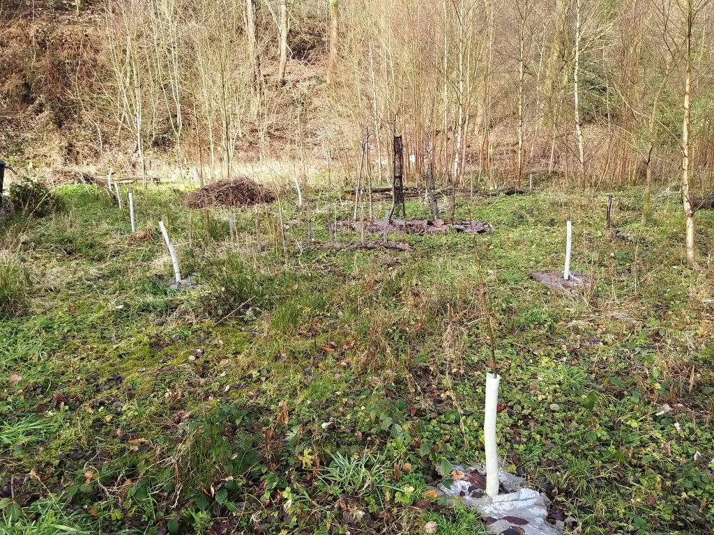
Looking East 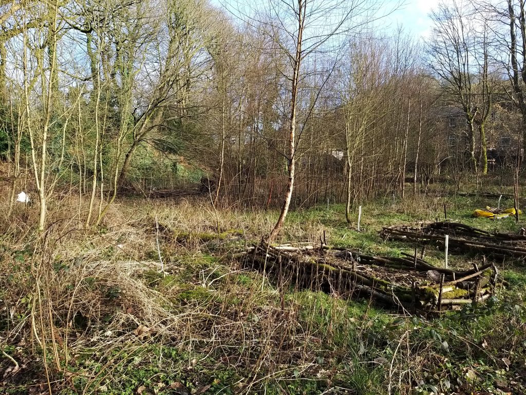
Raised Beds 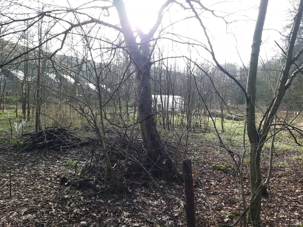
View from the Northern Corner 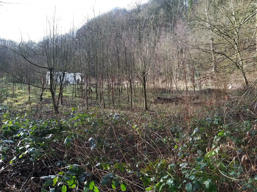
Birch Thicket
PASE (Plants, Animals, Structures, Events) Survey
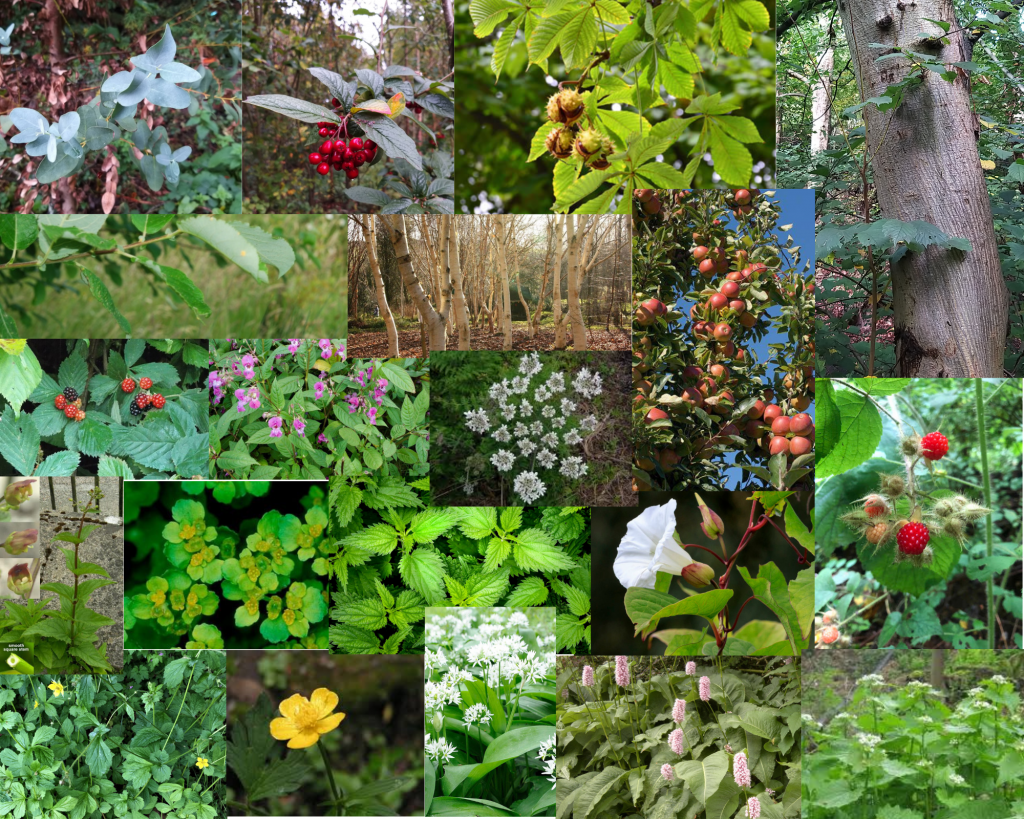
Plants
After an initial survey the following plants were found on site. There are probably others, and these can be added to the list after further plant surveys
NOTE: Japanese Knotweed is found not far away, but is not on this site at present.
| Name of Plant | Edible? | Needs Controlling? |
|---|---|---|
| Creeping Buttercup | Yes | |
| Himalayan Balsam | Yes | Yes |
| Bindweed | Yes | |
| HogWeed | Yes | Yes |
| Bramble | Yes | Yes |
| Raspberries | Yes | Not at present |
| Wild Garlic | Yes | Potentially |
| Bistort | Yes | Potentially |
| Common Figwort | ||
| Garlic Mustard | Yes | |
| Opposite-leaved Saxifrage | ||
| Hedge Woundwort | ||
| Nettle | Yes | Yes |
| Mountain Elm | ||
| Apple Trees | Yes | |
| Birch | Sap | Potentially |
| Goat Willow | Potentially | |
| Horse Chestnut | ||
| Apple Eucalyptus | Potentially |
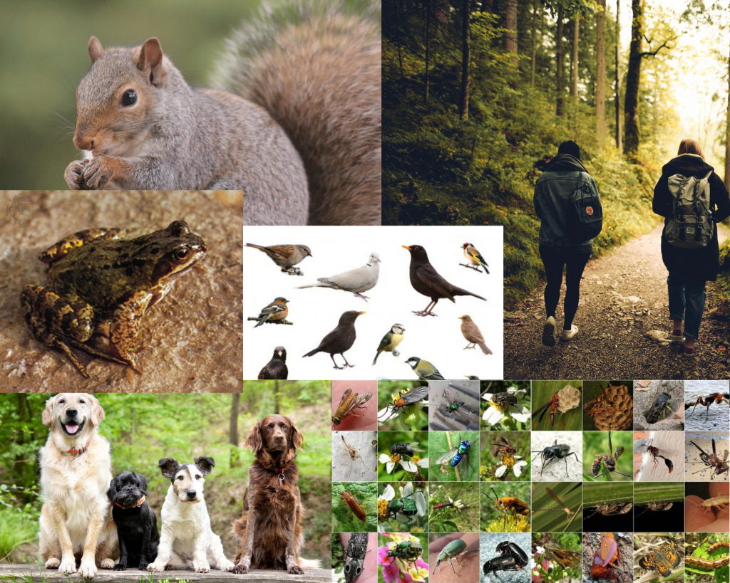
Animals
A thorough fauna survey has not been carried out. The site has many frogs and birds. Occasional squirrels are spotted. The location and frequently used footpaths does mean that there are not significant numbers of deer.
Structures
The site is surrounded on 3 sides by a tarmac path.
A living fence has been installed on 2 sides.
A brash and bramble fence borders one side.
3 vegetable beds have been constructed with logs, but not yet filled or planted up.
There is a polytunnel adjacent to our site. This is owned by the Healthy Minds allotment group.
Events
The site is prone to seasonal flooding and waterlogging after prolonged heavy rain. This is worst in winter.
The sheltered nature of the site means that despite its south facing aspect, it acts as a frost pocket and does hold onto frost and snow longer than the surrounding area. The area with greater tree cover is not as affected than the open area.